▶
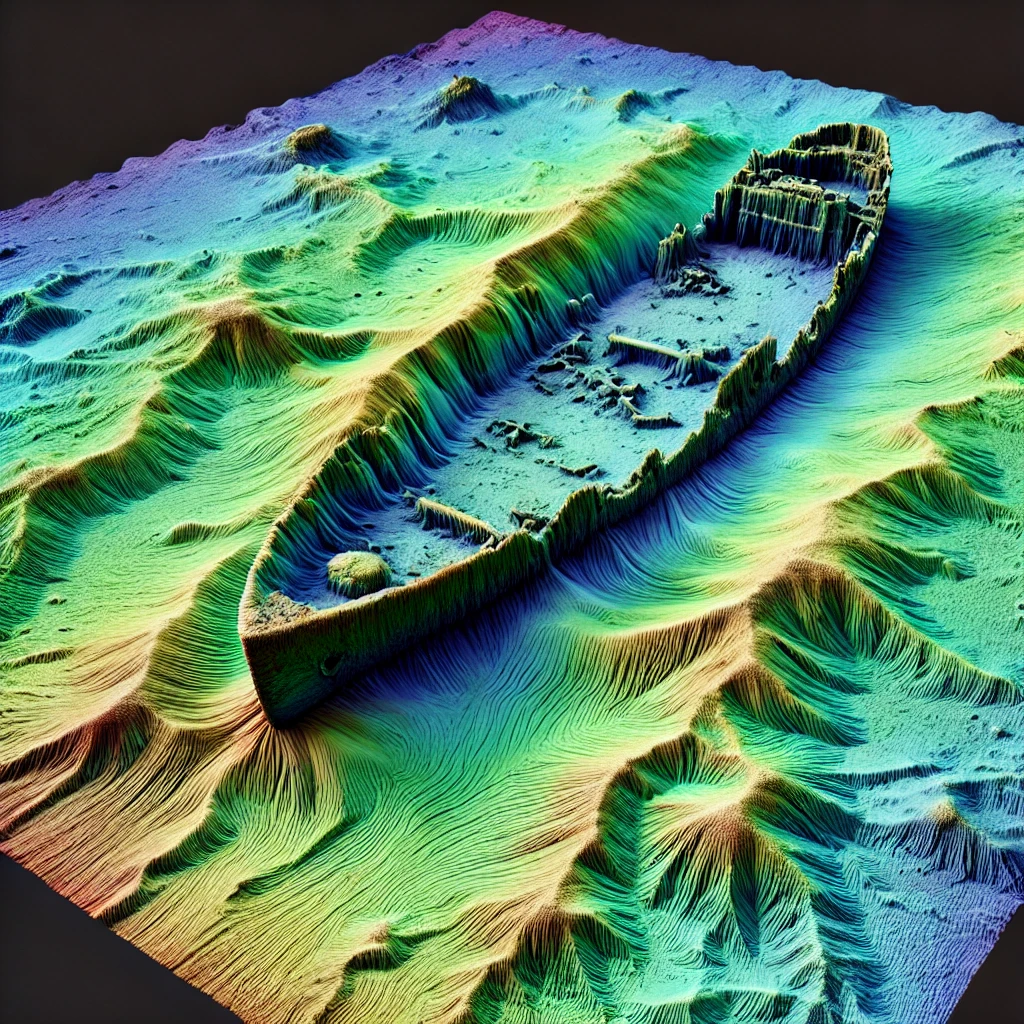

The Irish wreck map brings together shipwreck records and seabed survey information from INFOMAR, Ireland's national programme for mapping the seabed. It allows wreck sites to be explored alongside the survey data used to record and investigate them, rather than viewing wreck positions in isolation.
Select a wreck on the map to view available information including vessel name, vessel type, wreck dimensions, water depth, survey references and comments. Some records also include survey imagery, reports or links to three-dimensional models produced from seabed survey data.
INFOMAR surveys Ireland's coastal and offshore waters using modern hydrographic techniques including multibeam sonar. These surveys record the depth and shape of the seabed and can reveal wrecks, geological features and other objects lying on or above the sea floor.
Wreck detail varies according to the resolution, age and purpose of each survey. In high-resolution areas the outline of a hull, superstructure and associated debris may be visible, while other sites are represented primarily by a recorded position and wreck information.
The map includes INFOMAR backscatter survey coverage. Backscatter records the strength of the sonar signal returned from the seabed and can reveal changes in seabed character as well as the presence of wrecks and other features.
Bathymetry and backscatter provide different views of the same underwater landscape. Bathymetry records the shape and depth of the seabed, while backscatter can help show differences in the material or roughness of the seabed surface.
The wreck records, survey information and associated imagery shown on this map are derived primarily from publicly available INFOMAR and Irish public-sector marine datasets. Individual records can vary in completeness, and wreck identifications, dimensions or positions may be revised as further surveys and historical research become available.
More information about datasets, licensing, historical research and the way Wrecksite.uk handles conflicting source information is available on the sources and methodology page.
Some wrecks are explored in more detail in Spotted, where seabed survey data is combined with historical research, photographs, archival material and, where available, three-dimensional survey data. These features look beyond the database record to examine both the vessel and what survives on the seabed today.
Wrecksite.uk is provided for historical, educational and research purposes. Wreck positions, water depths, seabed imagery and other information displayed here should not be relied upon for navigation, diving safety or other operational purposes.